Where Do Most Car Accidents Happen in Knoxville: Car Accident Hotspots
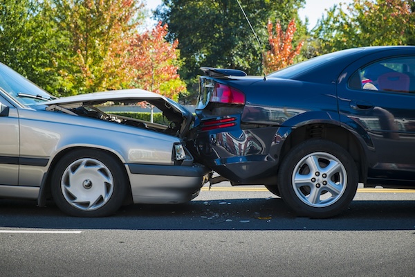
Most car accidents in Knoxville occur in specific hotspots around the city. Whether you’re commuting, running errands, or attending events, some areas are more prone to crashes than others. This blog highlights the key locations where accidents happen most often, helping you stay informed and safer on the road. The city’s vision for traffic safety, outlined in the Vision Zero Action Plan, aims to enhance safety for all road users by improving infrastructure and addressing high-injury areas.
If you’re wondering where most car accidents happen in Knoxville, this blog will highlight the key hotspots and dangerous areas where crashes occur most often, helping you stay informed and safe on the road.
The Knoxville Police Department works tirelessly to manage and reduce traffic incidents. The high frequency of motor vehicle accidents in the Knoxville region raises significant concerns for pedestrian and bicycle safety. By understanding the most dangerous roads and intersections, you can take precautions to avoid these areas and reduce your risk of being involved in a crash.
Introduction to Car Accidents in Knoxville
Knoxville, a city nestled in the Tennessee Valley, is known for its bustling streets leading to various retail centers and highways. Despite the city’s Vision Zero Action Plan, approved by the Knoxville City Council, which aims to reduce traffic-related deaths to zero by 2040, Knoxville remains one of the most dangerous cities to drive in.
The Knoxville Police Department provides crucial data on intersections with the highest number of crashes, helping to identify the most dangerous roads and intersections in the city. Among these, Chapman Highway, Clinton Highway, Western Avenue, and Asheville Highway stand out as particularly prone to traffic crashes and fatal crashes. These busy streets are often the scene of severe bodily injury or death, underscoring the need for continued efforts to improve road safety.
Chapman Highway: A Dangerous Stretch
Chapman Highway, which stretches from the southern edge of Knoxville, is not only one of the busiest roads in the city but also one of the most hazardous. This major arterial road connects commuters from Knoxville’s urban core to the surrounding rural areas. Chapman Highway begins near the south end of the Henley Street Bridge, an area that has become busier due to the closure of the Gay Street Bridge.
As it weaves through both residential and commercial zones, it becomes increasingly difficult for drivers to maintain control, particularly in areas like the highland drive chapman highway and areas with sharp turns. These stretches often lead to serious crashes, especially when drivers fail to adjust their speed or neglect to yield for cross traffic. The road is heavily trafficked, especially during rush hours, making it a hotspot for collision calls and traffic-related deaths. The intersection near the highland drive chapman highway is a particularly dangerous area, where a mix of high-speed commuters and frequent stop-and-go traffic increases the risk of accidents.
The intersection of Henley Street/Chapman Highway and East Blount Avenue is significant in the South Waterfront area, with a notable number of collision calls in 2024. The surrounding environment includes nearby apartment buildings and businesses, and the increased traffic due to the closure of the Gay Street Bridge.

Clinton Highway: High-Speed Danger
Clinton Highway, an essential link between Knoxville and its neighboring communities, sees a high volume of traffic on any given day. With multiple lanes in both directions, it’s a fast-paced road where speeding often becomes an issue. Drivers regularly exceed the speed limit, especially when the road feels more like a freeway, contributing to fatal crashes and serious injury accidents. Dangerous intersections, especially at double turn lanes, create a hazardous environment for those trying to navigate through this congested stretch.
The frequent merging of traffic from various entrances and exits only adds to the confusion. In addition, the presence of numerous shopping centers along the highway means more foot traffic and a higher risk of accidents involving pedestrians. These factors combine to make Clinton Highway a critical area for safety improvements. The intersection at Clinton Highway and Merchant Drive is just a mile away from Interstate 75, highlighting its accessibility and relevance in the area.
In 2024, the number of collision calls at the intersection of Clinton Highway and Tillery Drive has been significant, emphasizing the location’s importance near several neighborhoods and close to major interstate intersections.
Western Avenue and Norton Road
Western Avenue, particularly near the intersection with Norton Road, is a prime example of a heavily congested area with a high rate of traffic incidents. This critical intersection sees cars coming from all directions, leading to frequent accidents. It’s also located near the Knoxville Convention Center, and several retail outlets are nearby, leading to increased congestion during both work hours and special events.
The intersection of Western Avenue and Sanderson Road is a busy fast food area, characterized by heavy traffic and frequent vehicle movements due to the presence of fast food establishments and nearby highway access. As traffic builds up, both local and visiting drivers often struggle with navigating the area, leading to rear-end collisions and side-impact crashes.
The presence of pedestrians walking near the busy shopping areas, combined with the proximity to fast food restaurants, makes this intersection a hotspot for accidents. During rush hours, when the busy one downtown area and surrounding streets fill with vehicles, drivers must be especially cautious to avoid dangerous situations. The congestion caused by cars exiting highway ramps near the Knoxville Convention Center further exacerbates the traffic dynamics and potential collision risks in the area.
World’s Fair Park Events and Downtown Knoxville
Downtown Knoxville is one of the city’s most vibrant areas, but with its popularity comes a higher rate of accidents. The old City Hall, a landmark in a busy downtown intersection, is near L&N STEM Academy and Interstate 40 entrances. World’s Fair Park, which draws large crowds during events such as Tennessee Vols games, is a major hotspot for traffic crashes. With thousands of people flocking to the area, traffic is often heavy and unpredictable. A pedestrian bridge crosses Clinch Avenue and Henley Street, connecting to the Knoxville Convention Center. Merchants Towne Square and the South Waterfront area add even more congestion, as drivers and pedestrians navigate crowded streets.
During these busy times, the streets around Gay Street Bridge and the Henley Street Bridge become particularly dangerous due to confusing lanes and high volumes of traffic. Accidents are common here, often involving rear-end crashes or serious injury incidents as drivers become frustrated with the slow-moving traffic. The chaotic nature of downtown events contributes to frequent collision calls, with many accidents occurring simply due to overcrowding on the streets. The busy traffic and pedestrian activity around downtown Knoxville during Tennessee Vols games further highlight the area’s vibrant yet congested environment.
Dangerous Intersections: Where Accidents Often Happen
Knoxville is home to a number of dangerous intersections that contribute to a higher-than-average crash rate. One such location is the intersection of Schaad Road and North Broadway, a notorious area for traffic-related deaths and serious injury crashes. This intersection serves as a key access point to notable locations, such as shopping and dining areas in the city. The intersection lacks adequate signage and is surrounded by high-traffic zones, making it a confusing and hazardous spot for drivers, especially during peak hours.
Similarly, the intersection near Gay Street Bridge and Henley Street Bridge is one of Knoxville’s busiest, yet it suffers from poorly designed merging lanes and traffic bottlenecks. These congestion points lead to a higher rate of accidents involving motor vehicles, as drivers struggle to maneuver through tight spaces and navigate complex intersections. These areas, known as Knoxville crossroads, have experienced a high number of collision calls in 2024 and are under scrutiny by local authorities aiming to reduce traffic-related accidents.
High Traffic Volume on Alcoa Highway
Alcoa Highway serves as one of the busiest roads linking Knoxville to the airport and other nearby areas, and its high-speed nature makes it prone to accidents. The road’s high traffic volume, especially with the addition of new lanes and exits leading to fast food restaurants and other commercial areas, increases the likelihood of serious crashes. The intersection of Alcoa Highway and Ed Shouse Drive has a high number of collision calls, highlighting the dangers in this busy area. The road often becomes congested during peak hours, and merging traffic from both local streets and highways can be dangerous.
Additionally, the presence of pedestrians walking in intersections near these busy commercial areas adds another layer of risk. Drivers who fail to adjust their speeds to match the heavy flow of traffic are more likely to be involved in serious injury accidents.
Some crashes may not be reported or included in official data because drivers manage the insurance paperwork independently.
Asheville Highway Safety Concerns
Asheville Highway is notorious for being one of the most dangerous roads in Knoxville. A significant number of motorcycle accidents occur here, often due to visibility issues and drivers failing to check their surroundings and blind spots before changing lanes. The road’s design and lack of maintenance further contribute to the high number of accidents, making it a hazardous route for all users.
Drivers should exercise extra caution when navigating Asheville Highway, especially when approaching intersections or changing lanes. The Knoxville Police Department’s data on collision calls and response times can pinpoint areas where improvements are needed to reduce accidents and enhance safety on this perilous stretch.
Magnolia Avenue Accident Hotspots
Magnolia Avenue is another perilous road in Knoxville, with a high incidence of bicycle and pedestrian accidents. The lack of proper road markings and signage, combined with the avenue’s busy streets and numerous fast food restaurants, makes it a challenging area for pedestrians and cyclists to navigate safely.
The city’s Vision Zero Action Plan aims to address these safety concerns by implementing measures such as improved lighting, enhanced road markings, and increased enforcement of traffic laws. By understanding the accident hotspots on Magnolia Avenue, drivers can take extra precautions to avoid accidents and ensure a safer journey for all road users.
Busy Retail Areas and Shopping Centers
In busy retail areas like Turkey Creek shopping and Central Avenue Pike, traffic crashes are more frequent due to high volumes of vehicles and pedestrians. These roads see constant movement of both cars and foot traffic, making them especially dangerous. Specific intersections within the city’s busiest shopping areas are particularly significant for traffic flow and safety concerns. Drivers exiting fast food restaurants or stores nearby can often fail to yield or misjudge traffic flow, causing collisions.
Knoxville’s urban planning efforts, guided by the Knoxville Mayor’s Vision, focus on improving road designs in these high-traffic areas to reduce accidents. Efforts may include adding pedestrian bridges, reworking traffic signals, and redesigning intersections to improve the overall flow and safety of these retail hotspots.
The Norwood neighborhoods, located between notable intersections, are in close proximity to retail and restaurants, emphasizing the area’s significance and urban development.
Knoxville’s Major Arterials
The major arterials leading into and out of the city, such as Kingston Pike and Asheville Highway, are critical for traffic flow. However, they also serve as the scene for many crashes. With drivers often speeding to get in and out of the city, the combination of heavy traffic and frequent merging lanes leads to dangerous driving conditions. These arterials are near apartment buildings, retail centers, and schools, increasing the likelihood of pedestrian involvement in crashes. Rethinking the design of these areas to include more lanes, better signage, and safer crosswalks would greatly improve safety on these major roads.
Speeding and Aggressive Driving
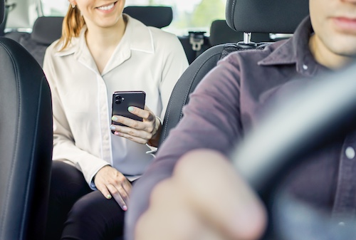
One of the primary contributors to accidents on Knoxville’s streets is speeding. Particularly on roads like Parkside Drive, Tillery Drive, and Ed Shouse Drive, where intersections are tight and traffic is heavy, speeding becomes a major hazard. In 2024, the intersection of Lovell Road and Parkside Drive saw a significant number of collision calls, highlighting its importance as an entry point to the Turkey Creek shopping and dining area.
Aggressive driving is also common, with drivers tailgating, running red lights, or failing to yield at stop signs. These reckless behaviors make already dangerous intersections even more hazardous. Dangerous roads and intersections within Knoxville and Knox County, such as those with high crash rates and recent infrastructure changes, emphasize the urgency of addressing these conditions. Increased police monitoring and enforcement of speed limits could help mitigate these issues, improving safety for all drivers.
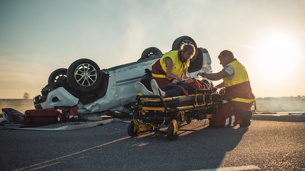
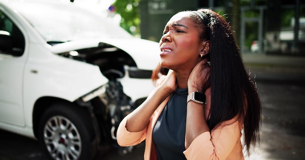
Injury Crashes
Injury crashes are a significant concern in Knoxville, with many accidents resulting in serious injury or death. The city’s high injury network highlights roads with a disproportionate number of serious crashes, including Western Avenue, Chapman Highway, and Clinton Highway. The Knoxville Police Department’s data on injury crashes is instrumental in identifying areas where safety improvements are needed. By analyzing this data and implementing measures to address the root causes of injury crashes, Knoxville can work towards its Vision Zero goal, creating a safer transportation network for all users.
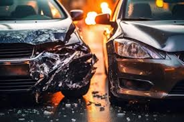
Collision Calls and Response
The Knoxville Police Department’s data on collision calls and response times is crucial for understanding the scope of traffic issues and identifying areas needing improvement. The data reflected in the department’s reports highlights the most dangerous intersections and roads in the city, such as North Cedar Bluff Road and North Peters Road, Lovell Road and Parkside Drive, and Western Avenue and Sanderson Road. By analyzing this data and implementing measures to address the root causes of collisions, Knoxville can reduce the number of accidents and improve response times. The city’s Vision Zero Action Plan aims to eliminate traffic-related deaths and serious injuries by 2040, and the police department’s data will play a critical role in achieving this ambitious goal.
Knoxville’s Vision for Safer Roads
As Knoxville continues to expand, the city is focusing on improving road safety. The Knoxville City Council and the Knoxville Mayor’s Vision are committed to reducing traffic-related deaths through the implementation of the Vision Zero initiative, which aims to eliminate fatalities and serious injuries. T
he Knoxville mayor’s vision underscores the importance of safety improvements for drivers, pedestrians, and cyclists, as part of the broader Vision Zero Action Plan, which seeks to address high-risk intersections identified through crash data. This vision includes improving the design of the city’s streets, particularly those around high-traffic areas and dangerous intersections. With continued support from the Knoxville Police Department, efforts to monitor and improve these hotspots will help ensure that Knoxville’s roads become safer for everyone.
The Tennessee Department may also be held responsible for accidents on dangerous roads due to issues such as improper design, lack of maintenance, or failure to provide adequate warnings to drivers.
Be Aware and Drive Safely
While Knoxville offers plenty to explore, it’s crucial for drivers to stay alert and aware of the high-risk areas where accidents are more likely to happen. Picture hotels and bustling establishments create a vibrant scene at a busy intersection in downtown Knoxville, where pedestrians and vehicles interact, especially during local events. From busy streets near retail centers to dangerous intersections, vigilance is key.
A specific intersection known for high traffic activity is particularly notable for its proximity to major neighborhoods and the presence of numerous retail and restaurant establishments. By following traffic laws, respecting speed limits, and staying conscious of pedestrians—especially in shopping areas and event centers—drivers can play a significant role in reducing accidents and improving safety for everyone. Take action today: drive carefully, stay informed about Knoxville’s accident hotspots, and help make our streets safer for all. If you find yourself the victim of an accident, call our firm 864-444-2062 to get the help you need.